CATEGORIES:
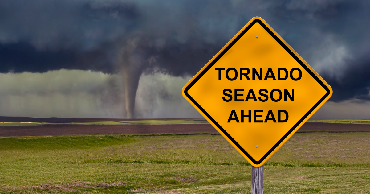
Why It’s Time To Stop Trusting The Tornado Season Calendar
December 26, 2025

When is tornado season? You want a concise answer so you can plan weekends, set alerts, and stop worrying. But, unfortunately, it’s tricky, and something about the old answer no longer holds true. The old “spring-only” mental model misses too many real risks, including the kind of late night twister that arrives when no one is watching the sky, except for meteorologists. That can lead to lost sleep in November, surprise sirens in January, and rushed decisions after dark.
What matters is that the calendar shows a peak, not a boundary. Tornado risk never shuts off in the United States, and in recent years, the most memorable, deadly, and expensive events have punched well outside the classic March–June window.
Key Insight: The tornado “season” calendar shows when the average day is busiest, not when your risk is zero. Treat the calendar like school traffic: rush hour is real, but cars still fly by at midnight, and the danger never disappears.
Why The Tornado ‘Season’ Calendar No Longer Matches Reality
The tornado “season” calendar no longer aligns with reality because the chart shows peak months rather than rigid boundaries, and the United States records tornadoes in every month of the year. Spring still dominates in the Plains, but insurance claims, fatalities, and headline outbreaks increasingly arrive during late fall and winter in the South and Mid-South. That mismatch builds false confidence. While we may be vigilant in the spring, we get complacent in the winter. That winter complacency costs minutes and minutes decide outcomes. Those lost minutes can also disrupt business, close offices, delay reopenings, and extend recovery well beyond the storm.
Think about December 2021: more than 200 tornadoes nationally, a staggering number, including a long-track EF4 that ripped across western Kentucky. Holiday lights blinked on quiet streets while a supercell chewed through towns after 10 p.m.; roofs peeled, glass blew across living rooms, and sirens fought the sound of wind that roared like a passing freight train. That night leveled the idea that “tornado season” ends with summer, and the destruction made the risk impossible to ignore. The next morning, a photo shared by neighbors showed roofs peeled back and debris strewn down the street.
Two things changed: the ingredients in the atmosphere and our view. Warmer Gulf moisture reaches farther, earlier, and longer as winter temperatures stay higher for longer stretches; powerful cold-season jet streams line up the wind shear that rotating storms love. At the same time, better radar coverage, phone cameras, and more people in harm’s way expose more tornadoes that the 1970s would have missed. The calendar never promised safety; it always described an average rooted in history.
How Tornado Risk Is Shifting Across The Year
Tornado risk is spreading into late fall and winter, with a clear secondary peak in November–December and sustained activity in January–February across the South and Southeast. The Plains still rev up in April–June, but the “off-season” now throws frequent overnight events from eastern Texas to the Tennessee Valley and into Florida.
March has begun creeping earlier into the severe weather season as favorable weather conditions arrive sooner and there are more days with rich moisture already onshore to increase the potential for early outbreaks. November and December carry more high-wind systems that organize both long-track supercells and tornadic squall lines.
And winter does not mean “weak”; many winter tornadoes spin inside fast-moving lines where winds at 5,000 feet scream at highway speeds. That’s why so many warnings arrive after bedtime: you wake to a phone alarm, rain slamming windows, and the power cutting out while you’re still half asleep.
Geography explains why winter cold fronts in the South can still produce tornadoes. The Gulf of Mexico sits a half-day drive from most of Dixie Alley, so any cold front that taps it can haul 60–65°F dew points inland in winter. Meanwhile, the jet stream is strongest in cooler months. During that time, wind shear, the change in wind with height, often reaches its annual maximum, even when people assume the risk is low.
Where The Nation’s Tornado Risk Is Moving
The center of high-impact tornado events has shifted east into the Mid-South and Southeast, an area now called Dixie Alley. However, the Great Plains still owns the big spring days. More supportive storm environments now meet more people and more vulnerable housing and buildings east of the Mississippi. The Midwest still experiences classic spring tornado risk, but the balance of impacts has shifted east.
East of the Plains, exposure runs high. There are more trees to hide funnels, more hills to block sight lines, and more manufactured housing that suffers in strong winds. If you factor in overnight storms, you’ll see why headlines hit Tennessee, Alabama, Mississippi, and Kentucky so often in cool months. Peer-reviewed work (for example, Gensini and Brooks, 2018) flagged this eastward tilt in favorable environments years ago; recent seasons have made that pattern obvious to anyone with a weather app.
The Great Plains vs The Mid-South
Risk in the Great Plains still spikes from April–June with classic dryline supercells, meaning wide horizons, visible structure, and afternoon warnings. But risk in the Mid-South thrives on fronts, especially warm fronts during fall and winter. This might show up as messy mode, meaning storms that are harder to visually identify, with low cloud bases, faster motions, and many warnings after dinner. Survival planning shifts accordingly: the Plains lean on spotter visibility and long lead times; the Mid-South leans on redundant alerts, safe rooms, and nighttime readiness. That difference shapes how people stay safe.
The Gulf Coast And Florida Peninsulas
Along the Gulf Coast and across the Florida Peninsula, winter cold fronts trigger severe storms and waterspouts that come ashore as tornadoes. Snowbirds might wake to tornado watches in January, lightning strobes in the morning sky, and narrow, rotating cells sometimes ride sea-breeze boundaries. Risk isn’t just summer thunderstorms; winter front days pack the bigger punch.
The Ohio And Tennessee Valleys
River-valley corridors catch fall and winter setups that sweep from Arkansas to Ohio. Warm fronts drape along the Ohio River, fog hangs in the low fields at noon, and then a deep trough barrels through near sunset. That’s a combo for severe weather in the evenings and overnight. Trees and terrain can hide embedded tornadoes until they are almost on top of towns.
How To Read A Tornado Season Map Without Being Misled
Treat any tornado season map as a 30-year average of where tornadoes happened, not a forecast for this year. Then, pair climatology with daily Storm Prediction Center (SPC) outlooks to get the real risk. A red blob on a map says “we’ve seen a lot here”; it does not say “you won’t see one there.”
Maps reflect detection. The Doppler radar era and dense population have increased report counts in areas with more eyeballs and better coverage. Older tornado records were later clarified through research archives and the Freedom of Information Act (FOIA), which helped fill gaps in early reporting. Frequency is not the same as intensity; regions with many brief EF0–EF1 tornadoes can outperform areas with fewer but stronger tornadoes. And a monthly “peak” on a graph doesn’t cancel the fat tails, or off-season weeks when two powerful systems double the monthly average.
Use maps to identify trends: when does your state usually see more activity, and which corridors light up most often? Then shift to forecasts to make decisions: SPC outlooks from three days out to the day of the event, (referred to as Day 3-1) along with mesoscale discussions, watches, and warnings. That combo gives you awareness without false comfort.
Frequently Asked Questions (FAQ) About Storm Season
Q: Do tornadoes really happen in winter now?
A: Yes. The United States sees tornadoes every month, and the South/Southeast frequently experiences winter events. December 2021 set a modern record for December with more than 200 tornadoes confirmed.
Q: Is Tornado Alley moving east?
A: The Plains still see major spring activity, but studies and recent seasons show more tornado-supportive environments and impacts in the Mid-South and Southeast, or Dixie Alley, especially in fall and winter.
Q: Does the map tell me if my town is safe this year?
A: No. Climatology maps summarize the past. Use SPC outlooks and local National Weather Service briefings for the next few days; that’s where actionable risk lives.
What To Know In Texas, Oklahoma, Alabama, Florida, And Kansas
State tornado timing differs: Texas and Oklahoma peak in spring; Alabama carries a pronounced cool-season risk, meaning fall and winter storms; Florida favors winter and early spring, plus summer waterspouts that sometimes move onshore; and Kansas peaks in late spring, with relatively less winter activity.
Texas
North and Central Texas peak March–June with dryline supercells, where dry air meets humid Gulf air, producing large hail and storms that sometimes spin tornadoes. Along the Gulf Coast from Houston to Corpus Christi, late fall and winter fronts bring storms inland from warm Gulf waters, and nighttime storm lines can spin quick tornadoes near warm fronts. If you live near I-35, watch spring; if you live closer to the coast, respect those December–February fronts that arrive with sticky air at breakfast and warnings by dinnertime.
Oklahoma
Oklahoma lives the classic April–May peak, with a smaller secondary season in late October–November when strong fronts pull Gulf moisture back north. Watches feel familiar in spring sunshine; in fall, risk sneaks in under low cloud decks that limit visibility. Dryline days reward sky-watching; front days demand tight alert settings because storms can evolve after dark.
Alabama
Alabama anchors Dixie Alley risk with two major windows: October–November seasonal shifts and January–March winter storm setups. Many events hit overnight. Heavy tree cover, rolling hills, and a high proportion of mobile/manufactured homes increase vulnerability by limiting visibility and access to shelter. Nighttime readiness saves lives here, with phone alerts on, a NOAA Weather Radio plugged in, helmets in the shelter room, and a plan to leave a mobile home when watches go up.
Florida
Florida’s cool-season severe weather peaks January–April with passing fronts, while summer sees plenty of waterspouts. Winter storms arrive fast before sunrise; warning polygons arrive while coffee brews. Tornadoes can be brief yet damaging along squall lines, leaving yards littered with palm fronds, screened pools shredded, and shingles scattered across wet pavement.
Kansas
Kansas specializes in late spring and early summer supercells, mainly May into early June, with fewer cool-season tornadoes than the Deep South. Storm-chasing culture thrives here because visibility helps; you can sometimes see a wall cloud from half a county away. Don’t ignore autumn, though; a stout November front can still deliver a quick, narrow swath of wind and a couple of tornadoes near warm fronts.
Which Months Now Bring Notable Outbreaks
![]() Recent notable tornado outbreaks have clustered in November–December and again in January–February along and east of the Mississippi River, even as early March can still deliver spring-like supercells.
Recent notable tornado outbreaks have clustered in November–December and again in January–February along and east of the Mississippi River, even as early March can still deliver spring-like supercells.
December
December outbreaks ride powerful troughs that pull Gulf moisture deep inland. The December 10–11, 2021 sequence produced long-track, violent tornadoes. One carved through western Kentucky well after 9 p.m., leaving a long, violent path through multiple communities. Neighbors woke to that low, growing roar, with phones buzzing on nightstands, and a power blink that left hallways black.
January
January events feature strong wind shear and quick-hitting lines from Texas to Georgia. You start the day in a hoodie; by evening, the wind rocks the porch swing, and a warning fires with 12 minutes of lead time. Many January tornadoes spin inside lines, so damage swaths look narrow, with fence posts snapped like toothpicks, roof sections folded back, and insulation tufts stuck to wet grass.
February
February often feels like early spring along the Gulf states. A warm, windy afternoon turns into a severe squall line by dinnertime. Supercells can run ahead of the line with discrete tornadoes, including curbs packed with storm drains gurgling, street signs bent, and tree bark sandblasted by debris.
The Fall Secondary Peak
October–November serves as a transition season. A sharp cold front undercuts humid air, and warm fronts drape across the Ohio and Tennessee Valleys. Many tornadoes strike right after sunset. Halloween decorations whip in gusts, blinking inflatables fold sideways, and a shelf cloud rolls over rooftops like a dark wave. That’s a tell: fast lift, strong shear, and organized lines.
Two fast stories, because consequences stick: A Tennessee mom silenced all alerts at 10:30 p.m. on December 10, 2021, because the kids finally fell asleep. A tornado warning polygon arrived at 11:08; she saw it at 11:21. It was a close call. Their hallway shelter held, and they got to it even with a preventable delay of eight minutes. Next day? $8,900 in roof and gutter repairs, a week in a hotel, a $2,000 deductible, damage to the property, and months of thinking about “what if.” A different household, three miles away, left a mobile home when a watch was posted. They parked at a friend’s site-built house and slept on the living room floor. Their mobile home took a direct hit. Their out-of-pocket cost that night: two pizzas and a tank of gas. Insurance handles paperwork later. Shelter decisions happen now.
How To Triage Off-Season Signals And Know When To Act
Use simple thresholds, like SPC outlooks, winter dew points near 60°F, and strong low-level wind shear. This will help you decide when to monitor, when to prepare, and when to shelter immediately. Off-season scanning does not require a meteorology degree; you only need a few bright flags that move you from curiosity to action. Think of these thresholds as a short list that helps you move from watching to acting.
Monitor
Monitoring starts when SPC highlights your region in Day 3–1 outlooks, and local National Weather Service offices raise awareness in briefings. If a three-day outlook paints a 15% area over your county, set a mental bookmark. Be sure to watch dew points; if values climb into the upper 50s during winter, the air holds more fuel than a typical cool day. Watch for warm fronts near you; those boundaries focus rotation, especially after dark.
Prepare
Tornado preparation time begins when SPC issues a Slight Risk (or higher) for your county, or when winter dew points reach ~60°F with a strong pressure gradient and a strong low-level jet in forecasts. Charge phones, stage helmets, shoes, and a flashlight in your safe room, and flip your phone’s Do Not Disturb settings to allow emergency alerts. If you live in a mobile or manufactured home, arrange where you will go if a watch is issued: church hall, neighbor’s site-built house, or a community shelter. Leave early if storms approach after dark.
Taking Shelter Immediately from a Tornado
Immediate action means seeking shelter the moment a Tornado Warning includes your location or a Severe Thunderstorm Warning mentions “tornado possible” with visible rotation on reliable radar. Modern alert systems like StormWarn help residents react faster by providing hyperlocal warnings and visual storm tracking that highlight their exact position relative to the threat.
Move to a small interior room on the lowest floor or a basement. Put on a helmet, cover your head, and keep your shoes on in case of debris. Because warnings often arrive with short lead times during winter or within fast-moving squall lines, shaving even 60 seconds off your response can prevent injuries from flying glass and collapsing interior walls.
Pro Tip: Set a “night mode” for severe weather days. Put phones on the charger, disable Do Not Disturb for emergency alerts, turn on location services for warnings, and place a NOAA Weather Radio where you can hear the alert tone from sleep. Also, remember that for parents, preparing for tornado season can be a little different!
Important: Never ride out a warning in a mobile or manufactured home. Leave when a watch posts or when storms are 30–60 minutes away, before wind and debris make travel unsafe. After storms, run generators outside and at least 20 feet from doors and windows to avoid carbon monoxide.
How To Stay 365-Ready During and Beyond Tornado Season
A quick quarterly routine keeps tornado preparedness fresh without burnout. Test your alerts, refresh your kits, review the shelter plan, and practice nighttime steps. Think of it like rotating smoke-detector batteries: small habits that shrink major risks.
Quarterly Safety Tune-Up for Tornado Season
Start with alerts: test the NOAA Weather Radio, confirm Wireless Emergency Alerts are ON, and check that your favorite radar app still has location permission. Review your shelter space: clear out anything heavy that’s out of place, stack blankets, stash helmets, closed-toe shoes, a whistle, and a hard copy of contacts. Refresh batteries and charge power banks. If you own a generator, run it for 15 minutes, top off fuel treated for storage, and verify cords are ready, no cracked insulation, no frayed ends. Power loss on a muggy winter night quickly turns the air heavy and the house humid; a ready generator turns hours without HVAC into a quiet inconvenience instead of a drywall-soaking mess.
Nighttime And Off-Season Drills
Run one 90-second “lights-out” drill per quarter. Kill the hallway lights, start in bed, and walk the family to the safe room with shoes and helmets. Time it. If it takes three minutes, fix bottlenecks: a nightlight near the shelter door, shoes parked closer, a spare leash for the dog. Those small choices carve seconds when warnings land with ten minutes’ lead time.
Trusted Sources And Tools
Use your resources wisely. Rely on the SPC outlooks for the big picture and your local National Weather Service office for “what today looks like in my county.” A local meteorologist can also help translate outlooks and warnings into what they mean for your neighborhood. Keep a NOAA Weather Radio for overnight alerts and Wireless Emergency Alerts on phones for polygons that match your location. Add one dependable radar app to visualize storm locations relative to your street. Many local National Weather Service offices also share short briefing videos on YouTube during high-risk setups.
Year-round attention does not mean year-round anxiety for everyone. It means you trade the false comfort of a calendar for the steadier confidence of simple signals and a repeatable plan. The result? Fewer surprises, less scrambling after midnight, and a safer home even when the calendar says winter.
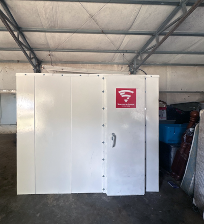
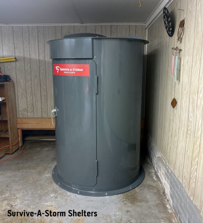
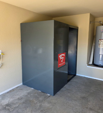
This content is designed to help homeowners make calmer, faster decisions when storms fall outside the usual calendar. If you’d like more information about tornado shelter options, reach out to us today. We are ready to answer questions and discuss the best tornado shelter solution for your needs.


